2.35 Acre Desert Homestead in Yucca
Tombstone Trail Lot 16 : Golden Valley, AZ 86413
Mohave County, Arizona
Land Description
Foundation Ready: 2.35-Acre Desert Homestead in Yucca Az
Property Overview
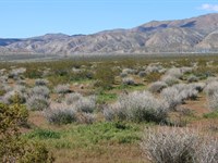
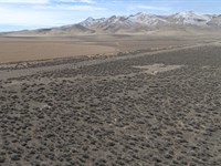
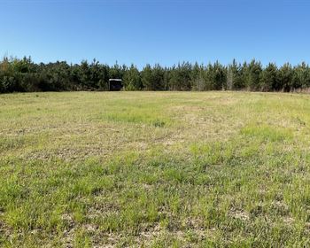
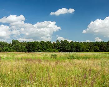
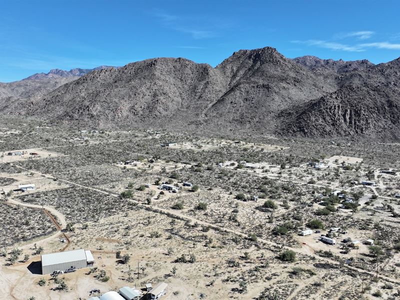
This 2.35 acre property in Yucca, AZ is located in Golden Valley Ranchos Unit 11 within Mohave County and carries Agricultural Residential zoning. The parcel sits at an elevation of about 2,654 feet. The land is flat, usable, and outside of any flood zone.
Access is provided via S Sherry Rd, a county-maintained dirt road. The property is outside city limits, offering fewer restrictions while still allowing residential development under county guidelines.
A concrete foundation is already in place on the parcel, which may reduce initial site preparation compared to raw land. With level terrain and existing groundwork started, planning your build or setup becomes more straightforward. Water would typically be supplied by drilling a well or hauling water, and a septic system would be required for residential use. The property is off-grid friendly while still allowing the option to connect to electric service if desired.
This is buildable land in Yucca AZ that offers flexibility, access, and usable acreage in a growing area of Mohave County.
Key Features
2.35 acres in Golden Valley Ranchos Unit 11 - (Plat available Here.)
Existing concrete foundation on site
RV living allowed per county guidelines
Site-built and HUD manufactured homes permitted
Camping allowed within county limits
Electric hookup possible, off-grid friendly setup
County-maintained dirt road access
17 minutes to central Yucca
43 minutes to Kingman
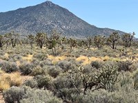
Joshua trees and open desert landscape
Payment Notes
$12,497 Discounted Cash Price
Flexible Owner Financing Options Available to Deserving Buyer at $15,997 financed price with only $3k down. Bank financing always welcome.
All Property Details
County: Mohave County, Arizona
Street: 11961 S Sherry Rd Yucca, AZ, 86438
Parcel number: 245-02-109
Size: 2.35 acres
Terrain: Mostly flat - desert with scattered vegetation, mountain views, and Joshua Trees
Access: County maintained dirt road - S Sherry Rd
Property zoning: (AR) - Agricultural Residential
RV's: Allowed - RVs can be permitted as a residence in the AR zoning
Mobile / Manufactured Homes: Allowed - Only HUD homes allowed, they must be manufactured after June of 1976 and have HUD number(s)
Camping: Allowed - Per County, camping is allowed for up to 14 consecutive days, and not to exceed 30 days in a calendar year
Tiny Homes: Allowed - must meet International Residential Codes of 2018
Short term rentals: No Restrictions
Covenants / POA / HOA: None
Taxes: ~$33.14 annually (2025)
Electric: Available nearby - UniSource is power provider in the area - Off-Grid Friendly
Water: Will need to install a well
Sewer: Will need to install a septic system
Flood Zone: Not in a flood zone, per Fema and Mohave County. Unshaded Zone X.
Utilities disclaimer: Due to the remote nature of the property, utilities may be difficult to obtain due to access and location. We do not make recommendations on any vendors. The utilities installer contacts listed are purely for your information. There may be other options available in the area. Please use this information at your own discretion
“Refer someone who buys land from us and we will pay a referral fee..”
As a nationwide real estate investment firm specializing in land acquisition and sales, we empower our clients to make informed decisions. Although we don't conduct on-site meetings, we strongly recommend you visit the property to experience its potential firsthand. Ready to explore? Contact us today to arrange your site visit.
Disclaimer: We make every effort to provide accurate and up-to-date information about this property based on available public sources and our own research. However, it is the buyer's responsibility to verify all information, including but not limited to: zoning, access, utilities, buildability, and permitted uses. All buyers are encouraged to conduct their own due diligence before purchasing. This property is sold “as-is” with no warranties or guarantees, expressed or implied.
Land Maps & Attachments
Directions to Land
Starting in Yucca, AZ 86438 in front of the USPS, head south on Frontage Rd toward W 12435 S St for 0.3 miles. Turn left onto Cal-Ari Dr for 0.2 miles, then turn right onto Alamo Rd for 3.1 miles. Turn left onto Boriana Mine Rd for 4.5 miles, then turn left onto Suzette Rd for 0.4 miles. Turn right at the 1st cross street onto Mary Beth Dr for 0.2 miles, then turn left onto Sherry Rd for 459 feet to reach your destination at the 2.35-acre property at 11961 Sherry Rd, Yucca, AZ 86438.
Total distance: 8.8 miles, approximately 16 minutes.
More Land Details
Land Price History
More Land from Scott Taylor
 2 AC : $80K
- 3.8 AC : $39K
- 1.6 AC : $24.2K
- 1 AC : $19K
- 2.1 AC : $64.9K
- 5.1 AC : $19K
- 4.9 AC : $25K
- 5 AC : $27.5K
- 5 AC : $6K
- 0.4 AC : $17K
- 17 AC : $87.5K
- 0.2 AC : $200K