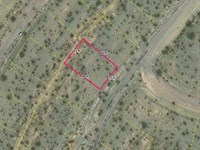
.24 Acres in Salton City, CA
2355 Sand Ere Avenue : Salton City, CA 92274
Imperial County, California
Land Description
Owner financing available: $143 down, then from $143/Mo for up to 210 months, or $14,295 cash. Pay it off anytime with no penalty, and no doc fees or closing costs.
- Power Is Located At The Property Line
- Existing Homes Nearby
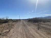
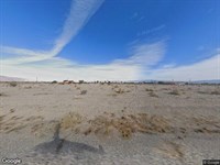
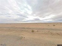
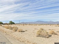
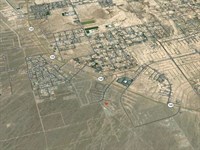
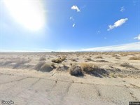
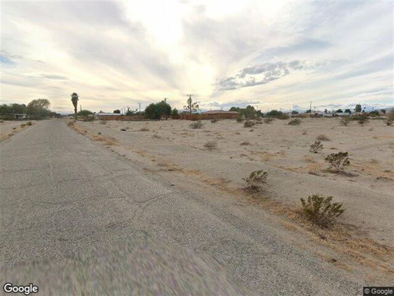
This is a parcel on a real street, not a stake in open desert. Sand Ere Avenue runs paved out front, and the lot sits in one of Salton City's platted grids where homes are already scattered up and down the surrounding blocks. The ground is flat and sandy, dotted with low scrub, with neighbors close enough that you're plainly inside a neighborhood rather than off on your own.
Power runs to the property, with the power lines running right behind the parcel. Water and sewer are both at the street line out front. On a lot this size, in this stretch of the desert, having all three already at the edge of the property is far from a given.
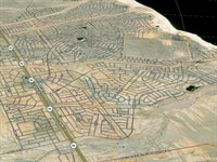
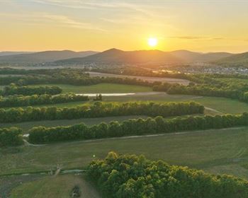
Salton City itself has one of the more interesting stories in California. It was laid out in 1958 as a resort city meant for tens of thousands of people, drawing boaters, water skiers, and a Hollywood crowd through the '50s and '60s before the grand plan fizzled. What's left is this enormous platted footprint along the Salton Sea, now better known for bird watching at the shoreline, the off-road country at Ocotillo Wells, and the desert art at Slab City and Salvation Mountain that pulls photographers and curious travelers out here year after year.
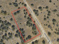
You're looking at roughly 10,500 square feet of flat, residential-zoned ground, owner financed with no credit check and no bank in the way. If owning a piece of this corner of the Imperial County desert appeals to you, this one makes it easy for you to get started today.
----------------------------------------
[ Location ]
Location: Salton City
County: Imperial
State: California
Address: 2355 Sand Ere Avenue
Gps: 33.298838, -115.948320
[ Land ]
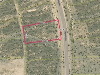
Size: 10,561 sq ft
Access: Paved Road
Slope: Flat
[ Zoning ]
Zoning Type: Residential
Zoning Subtype: Single Family
Zoning Code: R-1
Zoning Description: Low Density Of One Unit Per Lot Maximum Residential Area
Parcel Use Code: Rvxx
[ Records ]
Parcel Number:
Legal Description: Lot 29 Block 26 Tract 532 FM 4 3
[ Fees & Taxes ]
Estimated Property Tax: $149/Year (2025)
HOA: None
[ Financing ]
Cash Price: $14,295
Down Payment: $143
Monthly Payment: $143 - $301
Term Length: 60 - 210 months
Interest Rate: 10%
Document Fee: $0
Closing Costs: $0
----------------------------------------
Get started for $143 down
Land Maps & Attachments
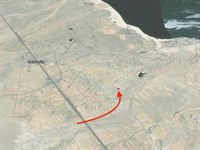
Directions to Land
Driving directions to the property at 2355 Sand Ere Avenue
From: Los Angeles, CA, USA
About 167 mi, 2 hr 54 min driving.
1. Head southwest on Harbor Freeway, CA 110 (0.6 mi)
2. Keep right (428 ft)
3. Keep left (0.9 mi)
4. Turn left onto South Main Street (1.3 mi)
5. Turn right onto East Aliso Street (0.2 mi)
6. Turn sharp left onto North Alameda Street (391 ft)
7. Turn right onto East Aliso Street, I 10 EXPR (10 mi)
8. Keep left onto I-10 Metro ExpressLanes, I 10 EXPR (4.0 mi)
9. Keep left onto I 10 EXPR (1.1 mi)
10. Keep left onto I-10 Metro ExpressLanes, I 10 EXPR (2.2 mi)
11. Keep left onto I-10 Metro ExpressLanes, I 10 EXPR (2.0 mi)
12. Keep left onto I-10 Metro ExpressLanes, I 10 EXPR (1.1 mi)
13. Keep left onto I-10 Metro ExpressLanes, I 10 EXPR (2.9 mi)
14. Keep left onto I-10 Metro ExpressLanes extension (proposed), I 10 EXPR (2.0 mi)
15. Keep left onto I-10 Metro ExpressLanes, I 10 EXPR (2.1 mi)
16. Keep left onto I-10 Metro ExpressLanes, I 10 EXPR (4.0 mi)
17. Keep left onto I-10 Metro ExpressLanes, I 10 EXPR (64 mi)
18. Keep left onto Sonny Bono Memorial Freeway, I 10, US 99 Hist (19 mi)
19. Keep right (13 mi)
20. Keep right onto Route 86, CA 86 (34 mi)
21. Turn left onto Sunrise Drive (449 ft)
22. Turn right onto Azure Avenue (0.6 mi)
23. Turn left onto Marina Drive (90 ft)
24. Turn right onto Harbor Drive (1.2 mi)
25. Turn left onto Sand Dune Place (317 ft)
26. Turn right onto Sand Ere Avenue (280 ft)
27. Arrive at Sand Ere Avenue, on the left
Note: the last stretch to a rural lot can be unpaved or unmapped - use the property's GPS (33.298838, -115.94832) for the final approach.
More Land Details
More Land from Chris Hoffman
 New2.4 AC : $27.1K
- New1.5 AC : $18K
- New0.2 AC : $15K
- New0.2 AC : $15.3K
- New0.3 AC : $13.2K
- New0.5 AC : $22.7K
- New0.2 AC : $15.9K
- New0.3 AC : $15.8K
- New0.1 AC : $12.2K
- New0.2 AC : $11.9K
- New0.3 AC : $16.7K
- New0.1 AC : $11.1K