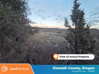
.25 Acre Near Scenic Lake in AR
Van Buren, AR 72031
Van Buren County, Arkansas
Land Description
Seller financing is available on all of our properties. Low down payments, low monthly payments and no credit check. Everyone qualifies.
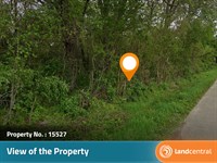
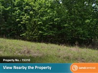
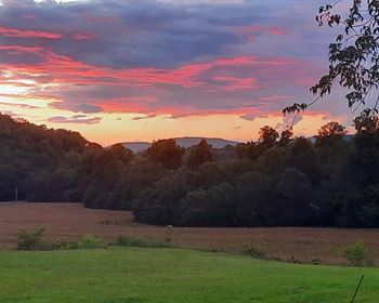
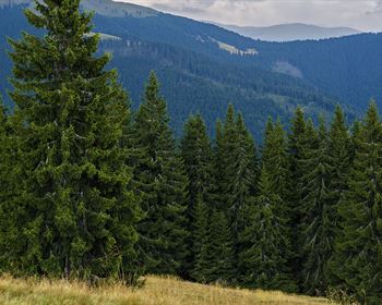
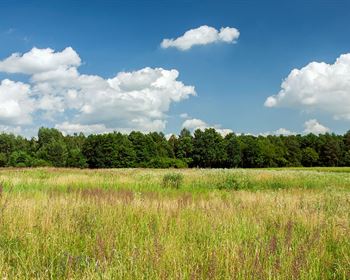
Just a quick walk from Greers Ferry Lake, this property is nestled in a peaceful setting where lush trees and gentle hills create a scenic, inviting backdrop. The surrounding area reflects the region's natural beauty, with verdant greenery and quiet streets that evoke a relaxed pace of life. Morning sunlight filters through the foliage, while warm, colorful sunsets add charm and calm to the evenings. With its serene atmosphere and connection to nature, this location captures the welcoming spirit of living in central Arkansas.
Lat/Long: 35.593234, -92.279586
Legal Description: Section: 17 Township: 11N Range: 12W Acreage: 0 Lot: 150 Block: 11 City: Addition: Lakewood SD: 03F
Land Maps & Attachments
Directions to Land
Little Rock Arkansas, USA
Get on I-630 E:
1. Head toward W 8th St
2. Turn right at the 1st cross street onto W 8th St
3. Use any lane to take the ramp onto I-630 E
Follow I-40 W/US-65 N and Hwy 65 S to AR-16 E/AR-9 N/Arkansas 16 E in Clinton:
4. Merge onto I-630 E
5. Use the left 2 lanes to take exit 139A-139B for I-30 E toward N Little Rock
6. Keep left and merge onto I-30 E
7. Use the left 2 lanes to take exit 143A to merge onto I-40 W/US-65 N toward Fort Smith
8. Take exit 125 for US-65 N
9. Use any lane to turn slightly right onto US-65 N/Hwy 65 S/Skyline Dr
Continue on AR-16 E/AR-9 N/Arkansas 16 E. Take Burnt Ridge Rd, The New Rd and W Cliff Dr to Timber Rd in Fairfield Bay:
10. Turn right onto AR-16 E/AR-9 N/Arkansas 16 E
11. Turn right onto Burnt Ridge Rd/S Fork Burnt Ridge Rd
12. Continue onto The New Rd
13. Continue straight onto Beaver Rd
14. Turn left onto Westwood Rd
15. Turn right onto Beaver Rd
16. Turn left onto W Cliff Dr
17. Turn right onto Dave Creek Pkwy
18. Turn right onto Timber Rd
More Land Details
More Land from LandCentral Company
 4.2 AC : $13.9K
- 0.2 AC : $2.8K
- 1.1 AC : $14.6K
- 0.5 AC : $22.5K
- 0.5 AC : $7.3K
- 0.2 AC : $2.9K
- 20 AC : $51.2K
- 1.5 AC : $34K
- 5.3 AC : $11.4K
- 2.5 AC : $10.8K
- 0.7 AC : $9.2K
- 0.4 AC : $5.6K