20Ac Fort Hancock, TX 62110 $247
Unnamed Road : Fort Hancock, TX 79851
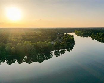
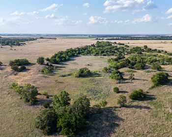
Hudspeth County, Texas
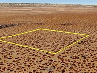
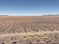
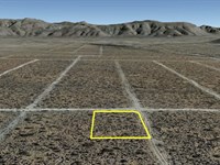
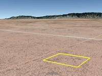
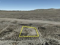
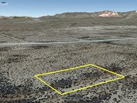
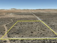
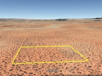
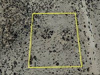
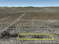
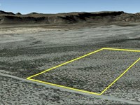
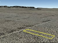
Land Description
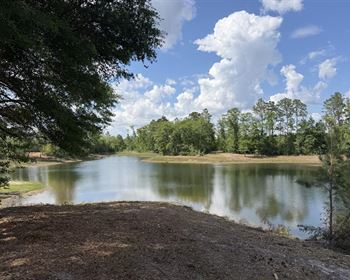
Own 20 acres of land in Fort Hancock, Texas, for only $247 a month. This big property is great for people who want to invest, collect land, or enjoy a quiet weekend escape. You can use it for camping, RV trips, adventure, or just to hold as land value grows over time. With lots of open space, fresh air, and peace and quiet, this land is a smart and simple way to own your own piece of Texas.
Pricing options:
Cash Price: $20,000
Owner Finance: $21,150 - $300 doc fee/$0 down & 94 payments of $247.94
($225 Loan Payment, $10.00 Service Fee, $12.94 property tax)
• No credit check
• No interest
• No prepayment penalties
Note: Down Payment & Doc Fee can be paid using credit or debit card. Monthly payments must be paid using ACH - checking account/routing number from a bank in the United States.
Important: While you can camp and enjoy your property while making payments, permanent residency is not permitted until the land is fully paid off. Weekend camping and recreational use are welcome.
Property details:
Acres: 20
Property Id: 62110
Legal Description: Tract(S) 3 Section 27 Block 075 Survey TP TWP (if applicable) 5 Unit 99
Hudspeth County, Texas. A total of 20 acres.
Recorded Deed: recorded purchase deed 20 Acres Hudspeth 62110
Surveyor's Description: Surveyor's Description 20 Acres Hudspeth 62110
Elevation: 4,150 ft.
Topography: flat
Roads: Dirt Road
HOA/POA: none
Utilities: none
This is off-grid land. There are no city utilities here. You can use batteries, a generator, solar panels or windmill for electricity.
For water you can bring it with you, drill a well, have water trucked in and delivered, set up a rain catchment system
Mineral Classified Lands: according to the Texas General Land office map, this property is “mineral classified land” which means that the State of Texas owns the mineral rights and splits them 50/50 with the current surface owner.
State: Texas
County: Hudspeth
Property Tax: $155.21
A phone app such as Land Glide or OnX Hunt can be used to find parcel lines and corners while walking the property (if using OnX Hunt be sure to add the “TX Private Lands” map layer to see the parcel lines).
GPS Coordinates:
NorthWest Corner: 31.478358°,-105.831209°
Southwest Corner: 31.474962°,-105.831184°
Southeast Corner: 31.474970°,-105.829090°
Northeast Corner: 31.478386°,-105.829151°
Ready to make this property yours? Have questions? Contact us today to start your journey to land ownership in beautiful West Texas.
Land Maps & Attachments
More Land Details
More Land from Billy Rogers
 10.3 AC : $11.2K
- New0.7 AC : $13.8K
- 0.4 AC : $3.7K
- 1 AC : $1.7K
- 0.8 AC : $6.9K
- 0.5 AC : $3.2K
- 5 AC : $25.5K
- 11.4 AC : $11.2K
- 0.4 AC : $4K
- 0.6 AC : $4.5K
- 5.2 AC : $10.4K
- 0.2 AC : $2K