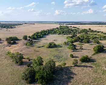
Heavily Wooded, Camp/Rv Or Build
Ramah, NM 87321
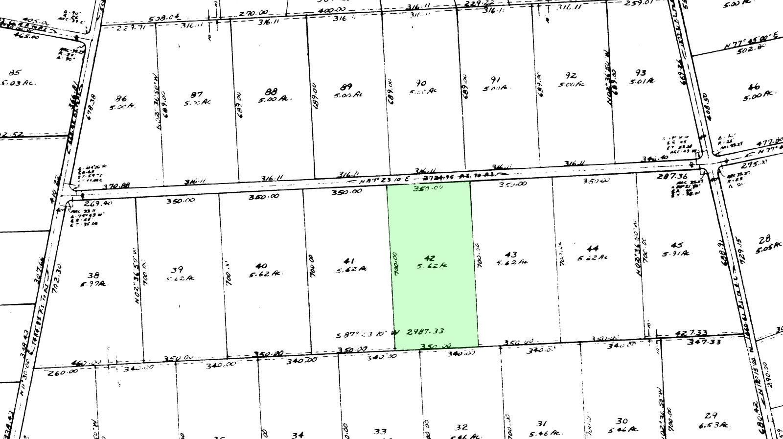
Cibola County, New Mexico
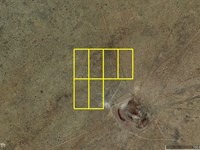
Land Description
5.62 Acres - Heavily Wooded - Camp/RV or Build - Tierra Verde Ranchettes, Nm
Unit 6, Lot 42 - Cibola County, New Mexico
________________________________________
Quick Highlights
• Approx. 5.62 acres
• Heavily wooded with small meadow openings
• Views of Cerro Leonides, Cerro Americano & Cerro Negra
• Borders area near El Malpais National Conservation Area
• Very private, quiet, and secluded
• Camp, RV, or build on your timeline
________________________________________
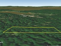
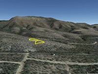
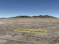
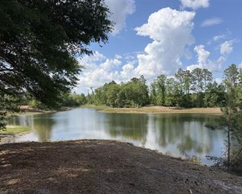
The Property
This is a beautiful, tree-filled parcel in Unit 6 of Tierra Verde Ranchettes-one of the more scenic parts of the subdivision.
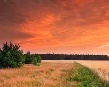
• Thick pinion, juniper, and other native trees
• Natural clearings scattered throughout
• Elevation around 7,500 ft ? mild summers, cool winters
The road easement is platted but not graded
There is an RV visible two lots away, suggesting access through the area
You can improve/grade the easement if desired (common in this subdivision)
________________________________________
Use It Your Way
• Camp whenever you want
• Bring your RV (no time limits mentioned in subdivision info)
• Build a home whenever-or never
No HOA
No required build timeline
Residential / recreational zoning
________________________________________
Wildlife & Surroundings
This area is known for:
• Elk, deer, bear, antelope
• Mountain lions, coyote, fox
A true off-grid outdoor environment
________________________________________
Location
• About 30 miles west of Grants
• Near:
o El Malpais National Monument
o El Morro National Monument
o Bluewater Lake State Park
Remote-but still reachable
________________________________________
Utilities
• Power: In subdivision (not typically at each parcel)
• Water: Well or water storage (verify with well driller)
• Sewer: Septic (when building)
________________________________________
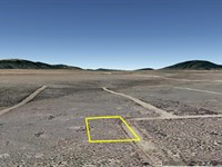
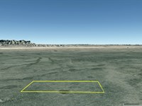
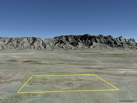
Property Details
• Subdivision: Tierra Verde Ranchettes
• Unit 6, Lot 42
• Size: approx. 5.62 acres
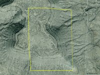
GPS Coordinates (corners):
• 34.922150, -108.212950
• 34.922139, -108.211761
• 34.920100, -108.211769
• 34.920100, -108.212939
________________________________________
Visiting the Property
• Driving directions are on our website
• 4WD recommended
• Some roads are rough, ungraded, or lightly overgrown
• All parcels have legal access via platted easements
• Corners are surveyed and pinned
________________________________________
Owner Financing - Everyone Qualifies
• No banks
• No credit checks
Start with $294 total initial payment
($99 down + $195 doc fee)
Payments as low as:
• $169.29/month for 12 years
Cash purchase available with 10% discount
________________________________________
Important Notes
• No commercial use while under financing
• No tree/brush removal while under loan (unless approved)
• Buyer to perform all due diligence
________________________________________
About Tierra Verde Ranchettes
A quiet, undeveloped subdivision with:
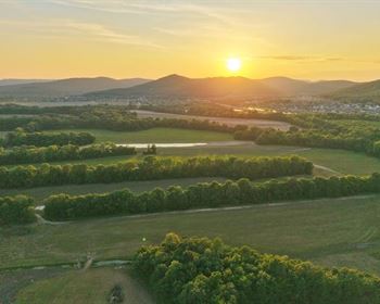
• Forested lots and open meadows
• Mountain views in every direction
• Near protected land ? no overcrowding
High-quality, affordable land like this is getting harder to find
________________________________________
Bottom Line
Large, wooded parcel
Secluded but accessible
Camp, RV, or build anytime
Low entry with owner financing
________________________________________
Next
To purchase or for more information, please click on the green Land Website button below.
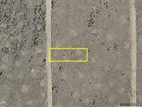
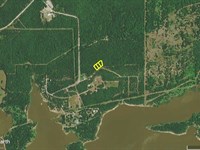
Land Maps & Attachments
Directions to Land
Travel about 28 miles west of Grants on Route 53.
About 1 mile west of the Bandera Ice caves turn south on Route 42. The coordinates of the intersection of Route 53 & Route 42 are 35.006586 -108.090403.
The roads are all dirt and they have some rough spots. Some of the ruts will fill up with water after a rain. To be safe you should be in a 4 wheel drive. There are no real hills at all, just some rough spots and some tire ruts that could get slippery. Route 42 is a dirt based road and has a clay based soil in most places. This soil will become extremely slippery when it is wet. It is not recommended to travel these roads when they are wet.
Go 7 to 7.5 miles. Route 42 is a pretty well maintained dirt road but has some rougher spots. Check out the lava flows that cross it in places.
Immediately past a shallow lake with a fence on the left (Laguna Americano), keep to the right. This is where you will be leaving Route 42. The coordinates there are approximately 35.006586 -108.162889. You will be getting close to a large cinder cone volcano.
Go about 100 feet to the next fork and bear left.
Proceed about 0.4 mile to the next fork and bear right.
You will have been traveling around the crater called “Cerro Americano” and you will be going around it on its left side so it will be on your right. You will be going around it in a clockwise direction. There is a sign nearby with the volcano's name on it.
In another 0.5 mile, at 34.929331 -108.179367 you will bear left at the fork and be turning away from the crater.
In 0.5 mile you will come to the entrance of Unit 7. There are some signs there and a cattle guard. The entrance is exactly at the northeast corner of Unit 7. The approximate coordinates for this entrance are 34.929900 -108.186500. You will follow the main subdivision road through Unit 7, where it is known as Cerro Americano Road. The name of the road as it enters Unit 6 changes to Cerro Leonides Road.
Once you get into unit 6 you will see the power line crossing the road.
The main subdivision road, where it exits Unit 7 and enters Unit 6 becoming Cerro Leonides Road, is approximately 34.924983 -108.203339.
After entering Unit 6 go approximately another 0.86 mile where you will then turn left off of Cerro Leonides Road at an intersection with a dirt road that you will see at approximately 34.925028 -108.217278.
About 0.2 mile later at 34.922278 -108.217947 the property will be approximately 0.29 mile east of you.
More Land Details
More Land from Samantha Stephens
 0.3 AC : $4K
- 0.8 AC : $18K
- 26.6 AC : $20K
- 0.4 AC : $5K
- 1.2 AC : $9K
- 0.3 AC : $3K
- 25.1 AC : $18K
- 11 AC : $24K
- 0.3 AC : $4K
- 7.5 AC : $12K
- 1 AC : $4K
- 0.3 AC : $7K