Paradise Lot for Just $299 Down
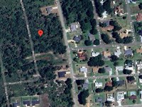
Dunnellon, FL 34431
Marion County, Florida
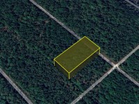
Land Description
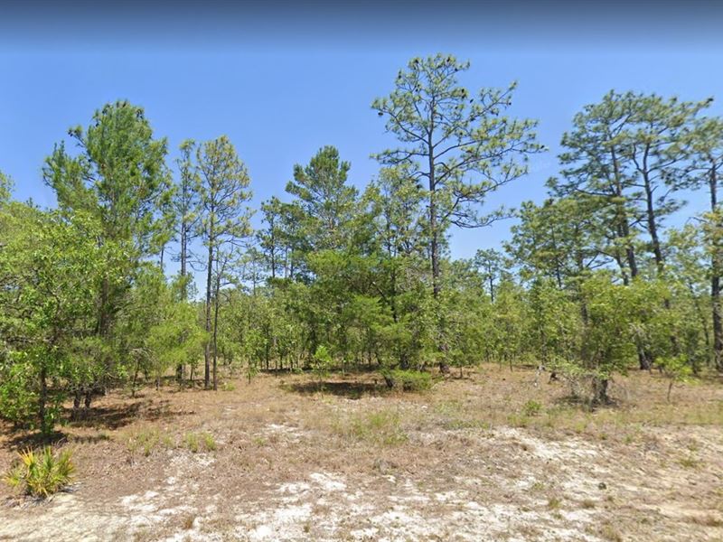
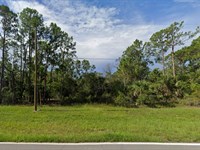
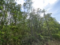
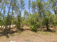
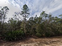
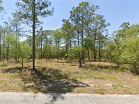
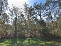
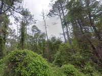
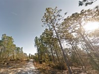
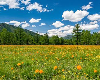
Step into your very own slice of Mother Nature's paradise in the heart of Dunnellon, Florida. This 0.23-Acre residential lot offers the perfect escape where peace, greenery, and possibility come together. With its flat, build-ready terrain, this property is like a smooth, open canvas just waiting for your dream home to take shape. Whether you're envisioning a cozy retreat or a smart investment, this land gives you the freedom to create something truly special.
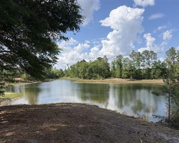
Enjoy the best of both worlds-quiet natural surroundings with easy paved road access that makes getting to and from your property a breeze. You're just a short drive from charming nearby towns like Inglis, Citrus Springs, Yankeetown, Inverness, and Williston, giving you access to everyday essentials while still feeling tucked away in nature. Adventure is always within reach too, with nearby gems like Blue Run of Dunnellon Park, Rainbow Springs State Park, and KP Hole Park-perfect for kayaking, hiking, and soaking in Florida's natural beauty.
This lot is zoned for residential use, offering flexibility for building (based on local guidelines), and comes with power available at the street for added convenience. Simply install your well and septic system, and you're ready to bring your vision to life. If you've been dreaming of owning land surrounded by nature, fresh air, and endless potential, this is your chance to make it happen. Your peaceful Florida lifestyle starts right here.
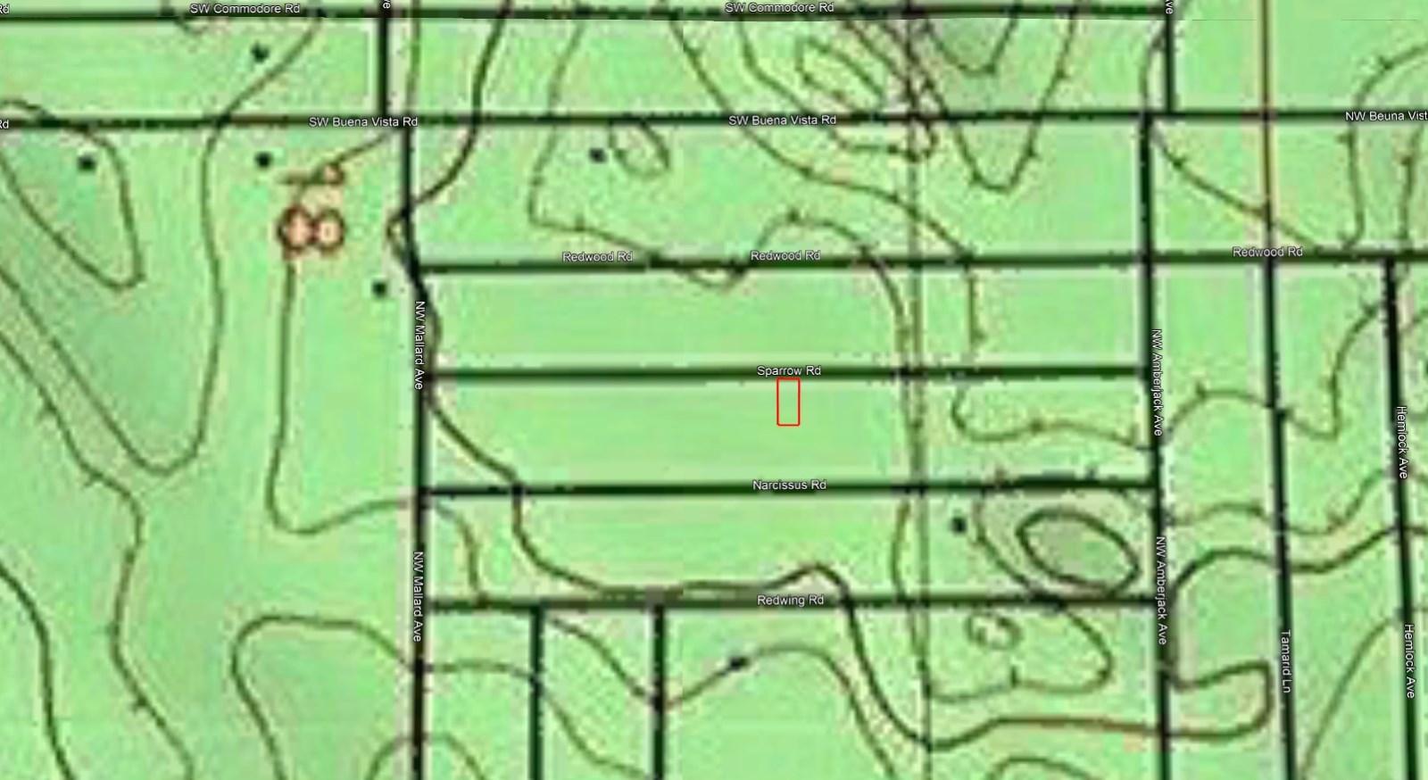
Location: Dunnellon, Fl
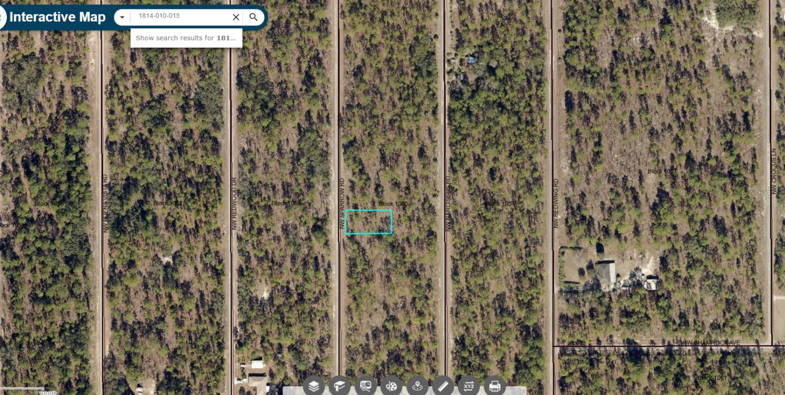
Size (Acres): 0.23
Zoning: Residential Zones (e.g. R-1, R-2)
Terrain: Flat with trees
Access: Paved Road
Nearby Cities: Inglis, FL (23 min, 20.6 miles), Citrus Springs, Fl (29 min, 20.3 miles), Yankeetown, Fl (28 min, 23.4 miles), Inverness, FL (48 min, 34.0 miles), Williston, FL (25 min, 20.5 miles)
Nearby Attractions: Blue Run of Dunnellon Park, Rainbow Springs State Park, Chaplin A. Dinkins III Memorial Park, KP Hole Park, Dunnellon Trailhead
Nearest highway: SE Co Rd 337 Dunnellon, FL & US Hwy 41 Dunnellon, Fl
Utilities:
Power: Power on street.
Water Well: You install.
Sewer Septic: You install.
What can be built? Generally, residential structures, possibly with restrictions on type and density.
Time limit to build? Specific to local ordinances and development plans.
Is camping allowed? Usually not.
Are RV's allowed? Often not, or possibly only temporarily.
Are mobile homes allowed? Depends on zoning sub-classification and specific regulations.
Lock In Your Land Today-It's Easier Than Ever.
Take advantage of this incredible owner financing deal with easy monthly payments and a very low-down payment to get started. No banks, no credit checks, and absolutely Zero% interest-just a simple path to land ownership. Act now to grab the cash discount price and enjoy peace of mind with our 90-day guarantee.
Don't wait-call us now and make this property yours today.
Important Notes:
- All of the information we have about this Property is contained on our Website Property Page.
- We ask that buyers do their own Due Diligence.
- You can visit any of our properties at any Time. GPS Co-ordinates and Driving Directions Given.
- Please call the Applicable County offices for any Specific Questions about the Property.
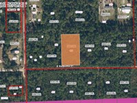
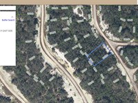
Land Maps & Attachments
Directions to Land
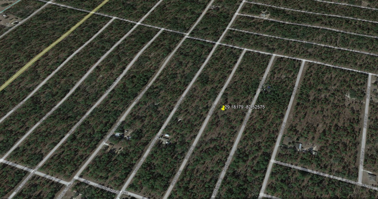
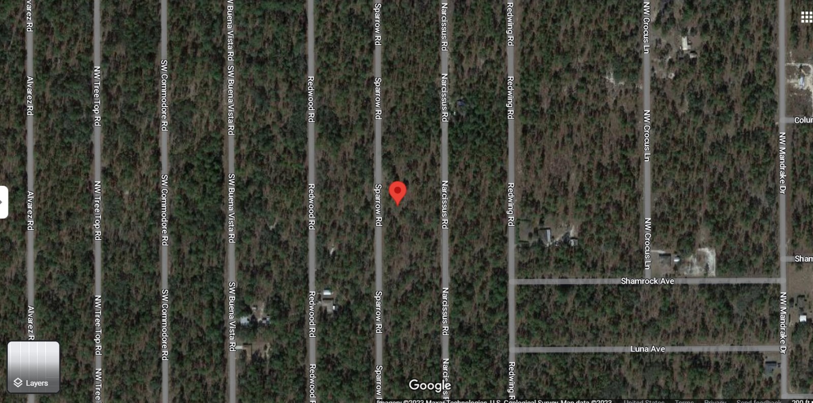
Gps: 29.18179, -82.52575
Gps Nw: 29°10'54.7"N, 82°31'33.5"W
Gps Ne: 29°10'54.7"N, 82°31'32.0"W
Gps Sw: 29°10'54.1"N, 82°31'33.5"W
Gps Se: 29°10'54.1"N, 82°31'31.9"W
Directions From Inglis, FL:
1.) Take US-19 N/US-98 N and FL-121 N to Falcon Ave.
(20 min, 19.3 mi)
2.) Head west on State Hwy 40 E toward US-19 N/US-98 N.
(131 ft)
3.) Turn right at the 1st cross street onto US-19 N/US-98 N.
(9.6 mi)
4.) Slight right onto FL-121 N.
(6.0 mi)
5.) Slight right onto SE 80th St.
(2.1 mi)
6.) Turn right onto NW Ridgewood Rd.
(1.5 mi)
7.) Continue on Falcon Ave.
8.) Take NW Beuna Vista Rd to Sparrow Rd.
(3 min, 1.2 mi)
9.) Turn left onto Falcon Ave.
(0.4 mi)
10.) Turn right onto NW Beuna Vista Rd.
(0.5 mi)
11.) Turn left onto NW Amberjack Ave.
(0.1 mi)
12.) Turn right onto Sparrow Rd.
13.) Destination will be on the left.
(0.2 mi)
Directions From Citrus Springs, Fl:
1.) Head north on N Greco Terrace toward W Astor Pl.
(18 sec, 492 ft)
2.) Take US Hwy 41 N, Co Rd 40, SE Co Rd 336 and SE Co Rd 337 to SE 120th St in Levy County.
(22 min, 16.5 mi)
3.) Turn right onto N Citrus Springs Blvd.
(1.5 mi)
4.) Turn left onto N Florida Ave/US Hwy 41 N.
5.) Continue to follow US Hwy 41 N.
(2.8 mi)
6.) Turn left onto Ned Love Ave.
(0.2 mi)
7.) Turn left onto W Pennsylvania Ave.
(348 ft)
8.) Turn right at the 1st cross street onto Co Rd 40/Cedar St.
(4.0 mi)
9.) Slight right onto SW Co Hwy 336.
(1.6 mi)
10.) Continue onto SE Co Rd 336.
(4.1 mi)
11.) Turn right onto SE Co Rd 337.
(2.4 mi)
12.) Follow SE 120th St to SW Half Moon Dr.
(2 min, 1.4 mi)
13.) Turn right onto SE 120th St.
(1.3 mi)
14.) Continue onto SW Sea Cliff Ave.
(427 ft)
15.) Continue on SW Half Moon Dr to Marion County.
(3 min, 1.2 mi)
16.) Turn left onto SW Half Moon Dr.
(0.9 mi)
17.) Turn right onto Indian Hill Dr.
(0.1 mi)
18.) Turn left onto SW Winding Hills Rd.
(0.1 mi)
19.) Take SW Buena Vista Rd to Sparrow Rd.
(3 min, 1.1 mi)
20.) Turn right at the 1st cross street onto Woodland Ave.
(0.3 mi)
21.) Woodland Ave turns left and becomes SW Buena Vista Rd.
(0.5 mi)
22.) Turn right onto NW Mallard Ave.
(0.1 mi)
23.) Turn left onto Sparrow Rd.
24.) Destination will be on the right.
(0.2 mi)
Directions From Yankeetown, Fl:
1.) Take 63rd St to SE 193rd Pl 1 min.
(0.4 mi)
2.) Head southwest on Harmony Ln toward 62nd St.
(449 ft)
3.) Turn right at the 2nd cross street onto 63rd St.
(0.3 mi)
4.) Take US-19 N/US-98 N and FL-121 N to Falcon Ave.
(24 min, 21.8 mi)
5.) Slight right onto SE 193rd Pl.
(3.8 mi)
6.) Turn left onto US-19 N/US-98 N
(8.3 mi)
7.) Slight right onto FL-121 N.
(6.0 mi)
8.) Slight right onto SE 80th St.
(2.1 mi)
9.) Turn right onto NW Ridgewood Rd.
(1.5 mi)
10.) Continue on Falcon Ave.
11.) Take NW Beuna Vista Rd to Sparrow Rd.
(3 min, 1.2 mi)
12.) Turn left onto Falcon Ave.
(0.4 mi)
13.) Turn right onto NW Beuna Vista Rd.
(0.5 mi)
14.) Turn left onto NW Amberjack Ave.
(0.1 mi)
15.) Turn right onto Sparrow Rd.
16.) Destination will be on the left.
(0.2 mi)
More Land Details
More Land from Kirk Peart
 1.1 AC : $29.6K
- 0.2 AC : $30K
- 0.5 AC : $24K
- 0.2 AC : $19K
- 0.2 AC : $13K
- 1.3 AC : $17K
- 0.2 AC : $18K
- 0.2 AC : $19K
- 1.5 AC : $29K
- 0.2 AC : $18K
- 0.2 AC : $12K
- 0.2 AC : $14K